
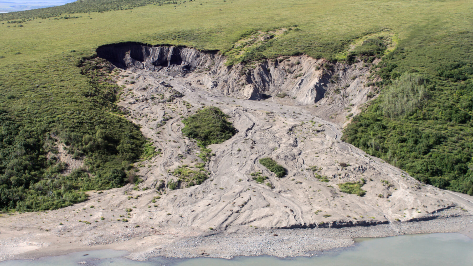
Soil is permafrost when it remains at 0 °C or lower for at least two consecutive years. It is the definition of the United States National Snow and Ice Data Center (NSIDC), and it carries a nuance that often surprises: permafrost is defined solely by temperature, not by ice or snow. It can be soil, sand, sediment, or rock, and it is enough for it to stay at that temperature for that duration to fall into the category.
The upper part, the so-called active layer, thaws and refreezes each year, while what lies beneath remains permanently frozen. In some places that ground contains a lot of ice (more than 30% of its content, according to NSIDC), and that detail explains a large part of what happens when it warms, since the ice is what keeps the ground firm.
It is worth not confusing it with glaciers or ice caps, which are masses of ice visible and whose melting has different consequences, which we review in what would happen if all the ice melted. Permafrost is in the ground itself and, from the outside, it is not always noticeable.
Where it is and how much area it covers
The NSIDC estimates that permafrost covers about 23 million square kilometers in the Northern Hemisphere, roughly 25% of the land that is not covered by ice. About 65% of that surface is in Eurasia and the remaining 35% in North America and Greenland.
It is not the only figure in circulation. A 2021 study by Obu and researchers, published in the Journal of Geophysical Research: Earth Surface, places it at about 14 million square kilometers (15% of that land). The distance depends on how it is measured: it is not the same to count the entire region where permafrost appears, even in patches, as to measure only the soil that is truly frozen. For this reason it is more prudent to speak of a range, between 15% and 25% of the Northern Hemisphere’s ice-free land.
What worries scientists is not so much the surface area as what lies within. For thousands of years, the cold has preserved remains of plants and animals that would have decomposed in temperate soils, and with them a huge carbon reservoir. Estimates of the size of that reservoir vary widely between sources, so the practical question is how much carbon could be released if the soil thaws.
Why it is dangerous when permafrost melts
The first risk is climatic. When the soil thaws, microbes begin to decomposed that organic matter and the carbon is released into the atmosphere as carbon dioxide or, in waterlogged and oxygen-poor soils, as methane, a gas that traps more heat than carbon dioxide. Andrew MacDougall and Reto Knutti calculated in a study published in Biogeosciences in 2016 that the permafrost region could release up to about 56,000 million tonnes of carbon if emissions are strongly curtailed (the low-emission scenario known as RCP 2.6) and about 102,000 million if they follow the higher pathway (the RCP 8.5).
The margins of those figures are wide (between 13,000 and 118,000 million tonnes in the first case, and between 27,000 and 199,000 million in the second), and the authors note that by around 2300 much more carbon would have been released in both scenarios. In this way, thaw fuels the warming that causes it, and researchers also follow what happens deeper down, where deep permafrost in turn influences the pace of climate change.
The second risk lies in the very ground: if the ice that gave firmness to the soil melts, the ground loses volume, subsides and cracks, and the buildings and roads built on top end up damaged. The best-known case is the Batagaika crater, in Siberia, a sinkhole that has kept growing.
The third has to do with what the ice kept still: as it thaws, some soils release metals and other substances that end up in the water, and a very visible example is rivers tinted orange.
The little permafrost that remains in Spain
Yes there is permafrost in Spain, though it is scarce, highly localized and diminishing. This is explained by the monitoring that Gómez-Ortiz and colleagues carried out in Sierra Nevada between 2001 and 2016, published in 2019 in the journal Permafrost and Periglacial Processes. Their conclusion is that the current climate of the range does not permit generalized permafrost: above about 2,500 meters what rules is seasonal frost, which freezes the soil in the cold season and disappears each year.
What remains are small remnants in the glacial cirques of the Veleta and Mulhacén, between 3,000 and 3,100 meters (cirques are the hollows carved by ancient glaciers). That ice is the legacy of the Little Ice Age, the cold period that Europe endured until the mid-19th century, and has endured because it is covered by thick debris, large rocks that insulate it from heat. The Veleta rock glacier (a mass of stones with ice inside) preserves permanently frozen soil, but is degrading.
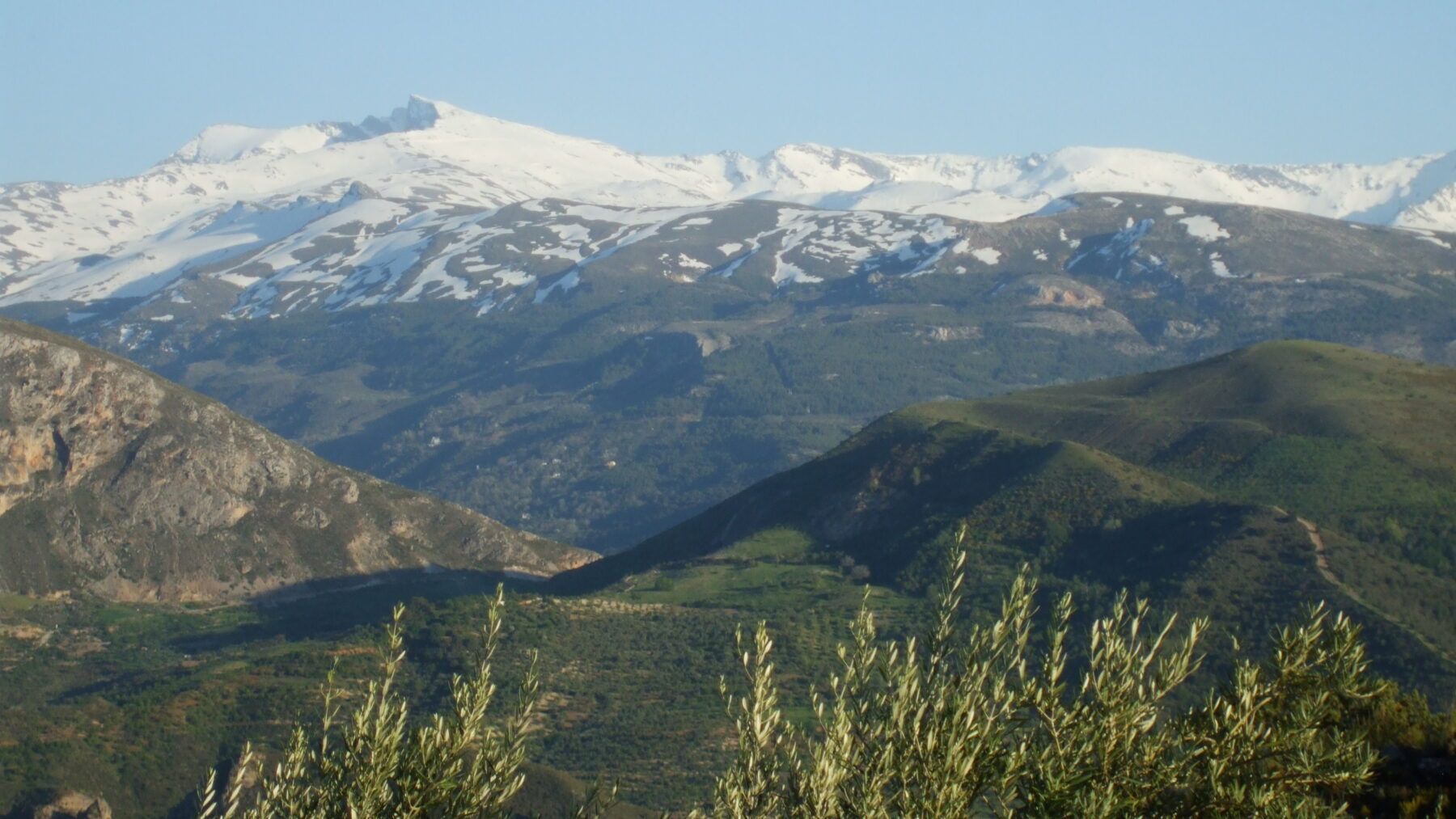
Not even on the summits does the threshold reach: on the high plateaus, at 3,300-3,400 meters, the mean annual soil temperature is 2.5 °C, above the 0 °C that marks the definition. And a borehole of 114.5 meters drilled into the Veleta rock in 2000, studied by Oliva and colleagues in 2016, found no permafrost regime, since at 20 meters depth the rock was around 2 °C.
Therefore, when speaking of Sierra Nevada permafrost, it concerns those concrete remnants beneath the rocks of the cirques and the Veleta rock glacier, not the icy crust that covers summit soils in midwinter, which is seasonal frost and vanishes each year.
In the Pyrenees there is more, though it is less well known. The Permapyrenees European project, which studies permafrost in the range between 2024 and 2027 with the Pirenaico de Ecología Institute (IPE-CSIC) and the Universitat de Barcelona among its partners, acknowledges that little is known beyond its existence in the upper zones, above about 2,600 meters, and almost nothing about how it will respond to warming. To find out, it plans to drill boreholes in massifs such as Monte Perdido, La Maladeta, Pica d’Estats or Besiberri. It is not just a scientific matter: according to the project, permafrost degradation has already caused rockfalls and slope instability on heavily frequented mountain routes.